The Tre Cime Loop Walk: Route, Time, Huts and What to Expect
The walk around the Tre Cime di Lavaredo is one of the classic mountain walks of the Alps. It circles three enormous rock towers, crosses a high pass with one of the most famous views in the Dolomites, and passes mountain huts where you can stop for lunch in the shadow of the peaks. It is also surprisingly accessible: the start is already high, the paths are well marked, and it can be done by most reasonably fit walkers in a day.
This guide describes the route, the time it takes, the huts and the highlights along the way, and the practical details — gear, weather, safety and guided options — that make for a good day.
The loop in brief
- Start and finish: Rifugio Auronzo, at 2,333 m.
- Paths: 101 and 105.
- Time: the local tourist board gives 4 hours for the full loop on paths 101 and 105.
- The guided version: a 10 km loop with about 400 m of ascent, via Forcella Lavaredo and the Locatelli hut, in about 5 hours at a guided pace.
- Season: summer and early autumn, when the road and the huts are open.
The loop is not technically difficult, but it is a high mountain walk, and the altitude, the weather and the length all deserve respect.
The three peaks
The loop circles three towers, and it helps to know which is which:
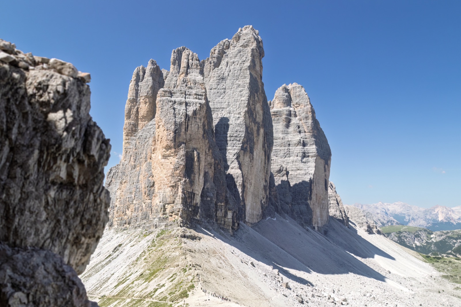
- The Cima Grande, in the middle, is the highest at 2,999 m.
- The Cima Ovest, the western tower, is 2,973 m.
- The Cima Piccola is the lowest at 2,857 m.
The Cima Grande was first climbed on 21 August 1869 by Paul Grohmann with the guides Franz Innerkofler and Peter Salcher. The peaks were already on the map long before: they appear as “3 Zinnern Spize” in the Atlas Tyrolensis of 1774.
The route, stage by stage
From Rifugio Auronzo
The walk starts at Rifugio Auronzo, on the southern side of the peaks. The tourist board gives 1½ hours on path 101 from the hut. The first stretch is broad and gentle, running beneath the southern faces of the three towers, which rise directly above you.
Over Forcella Lavaredo
The path climbs to Forcella Lavaredo, a pass on the eastern side of the peaks. This is where the famous view opens up: the three north faces standing side by side, sheer and enormous. For many walkers it is the highlight of the day, and the reason the Tre Cime are so often photographed from this side.
To the Locatelli hut
Beyond the pass, the route continues to the Locatelli hut, set among the rocks with a close view of the north faces. It is the natural lunch stop, and the terrace is one of the finest places to sit in the Dolomites.
Back around the western side
From the Locatelli hut, the loop continues on path 105 around the northern and western sides of the peaks and back to Rifugio Auronzo, completing the circuit.
Why the north faces are so famous
From the south, at Rifugio Auronzo, the Tre Cime look like a jagged ridge. It is only when you cross Forcella Lavaredo and see them from the north that they become the three separate, sheer towers of the postcards. The north faces rise almost vertically from the scree, the Cima Grande in the middle flanked by the Cima Ovest and the Cima Piccola, and their scale is hard to take in until you see climbers on them.
This is the view the loop is built around, and it is worth timing your walk so that you reach Forcella Lavaredo and the Locatelli hut with time to spare.
How long does it take?
Two sources give slightly different figures, and both are useful:
- The local tourist board gives 4 hours for the full loop on paths 101 and 105 — a good guide for steady walkers.
- The guided loop walk takes about 5 hours for 10 km with about 400 m of ascent, at a pace that allows for explanation and stops.
In practice, allow most of a day: add time for lunch at a hut, for photographs at Forcella Lavaredo and for simply standing and looking. Rushing the Tre Cime misses the point.
The huts
Huts on the loop serve food, and a lunch stop is part of the experience. The Locatelli hut, beyond Forcella Lavaredo, is the classic choice for its view of the north faces. Rifugio Auronzo, at the start and finish, is the other main stop. Huts open seasonally, so check they are open on your date.
History on the trail
The loop is not only about scenery. During the First World War, the front line ran through these mountains, and walkers still pass remains from that period. The guided walks from Misurina cover this history along the way, together with the geology of the peaks.
A sample day
- Early morning: arrive at Rifugio Auronzo by car (booked), shuttle or bus, and set off on path 101 beneath the southern faces.
- Mid-morning: climb to Forcella Lavaredo and take in the north faces.
- Late morning: continue to the Locatelli hut for an early lunch with the view.
- Early afternoon: follow path 105 around the western side and back to Rifugio Auronzo.
- Afternoon: head down to Lake Misurina or Dobbiaco, depending on how you came.
Shorter variations
Not everyone wants or has time for the full loop, and there are rewarding shorter options.
- Path 101 out and back: walk from Rifugio Auronzo beneath the southern faces towards Forcella Lavaredo, then return the same way. You see the peaks up close with less time and effort.
- To the Locatelli hut and back: continue over Forcella Lavaredo for the view of the north faces and lunch at the hut, then retrace your steps.
- From the valleys: for a full mountain day instead, walk up from Sesto (Val Fiscalina) or Landro – Vista Tre Cime on path 102, about 3½ hours each way to the peaks.
Photographs along the loop
- Beneath the southern faces, near the start, for a sense of the scale of the towers.
- At Forcella Lavaredo, for the classic side-by-side view of the three north faces.
- From the Locatelli hut terrace, where the north faces fill the frame.
- On the western side, looking back along the loop.
Early starts give quieter trails and fewer people in your pictures.
Early summer and autumn
The walking season is short, and its two ends feel quite different.
- In early summer, soon after the road opens, snow can linger on the northern side and around the passes. Check conditions and wear boots with a good grip.
- In high summer, the loop is at its busiest; start early and expect company.
- In autumn, the trails are quieter and the light is lower and softer, but the huts begin to close and the road shuts for the season — usually by late October.
Mistakes to avoid
- Arriving without a road booking. The toll road requires advance booking of parking and the toll.
- Starting late on a summer day. Afternoon weather can turn, and the trail is busiest at midday.
- Underdressing. It is cold and windy at this altitude, even in summer.
- Leaving the path. The towers are for experienced climbers; walkers stay on the marked routes.
- Counting on a hut that is closed. Huts open seasonally; carry food and water in case.
- Treating it as a stroll. It is a high mountain walk; give it the time and respect it deserves.
What the terrain is like
The loop follows well-marked paths, mostly wide and stony, over open, rocky ground high above the tree line. The first stretch from Rifugio Auronzo is broad and gentle; the climb to Forcella Lavaredo is steeper but short; and the return on the western side has its own ups and downs. On a clear day the whole route is exposed to sun and wind, and there is little shelter between the huts.
It is not a technical walk — there is no scrambling on the standard loop — but the altitude makes every climb feel harder than it would at lower levels. Take the ascents slowly, and remember that the guided version adds up to about 400 metres of climbing over 10 kilometres.
Accessibility
The loop is a mountain walk on rough, stony paths with climbs and descents, so it is not suitable for wheelchairs or for visitors who cannot walk on uneven ground. For visitors with limited mobility, Rifugio Auronzo itself — reached by car, shuttle or bus — gives a close view of the southern faces without any walking beyond the car park, and the day trips from Venice stop at viewpoints over the peaks and the lakes.
Combining the walk with Misurina and Cortina
The loop leaves plenty of time for the area around it. Lake Misurina is close to the start of the toll road, and the guided walks from Misurina begin there. Cortina d’Ampezzo, a little further away, is the classic Dolomites resort town, included in the day trips from Venice. After the walk, an evening by Lake Misurina with the peaks reflected in the water, or a stroll in Cortina, rounds off the day.
Guided walks
Two guided options start at Misurina and include the transfer to the hut:
Guided loop walk around the Tre Cime. A 10 km loop with about 400 m of ascent from the Auronzo hut, via Forcella Lavaredo and the Locatelli hut, in about 5 hours. The toll-road transfer from Misurina is included, and the guide covers geology and First World War history.
Small-group hike from Misurina. A transfer from Misurina to the Auronzo hut, then a hike past the south and north faces of the peaks, with huts for lunch on the way. Four walkers at most, in about 5 hours.
A guide is not required on the loop, but it adds context, company and confidence, especially if you are new to the mountains. The tours page lists both.
Getting to the start
- By car: the 6 km toll road from near Lago d’Antorno to Rifugio Auronzo, booked in advance (€40 for a car in 2026).
- By shuttle: line 444 from Dobbiaco, 31 May to 11 October 2026, €22 return for adults, booked online.
- By bus: Dolomitibus runs public buses up to Rifugio Auronzo.
- By bike: cyclists can ride the road free of charge.
- On foot from the valleys: from Sesto (Val Fiscalina) on path 102 (3½ hours), from Landro – Vista Tre Cime on path 102 (3½ hours), or from Val Campo di Dentro on path 105 (4½ hours).
Our guide to getting to the Tre Cime has the details.
When to walk
- Season: the road to Rifugio Auronzo is open only in summer and early autumn — usually from late May to late October, weather permitting — and the shuttle runs from 31 May to 11 October 2026.
- Time of day: start early. The loop is popular, and the first part of the day is the quietest on the trail.
- Weather: the peaks make their own weather. Check the forecast and be ready to turn back.
What to bring
- Walking boots or sturdy shoes with a good grip.
- Warm and windproof layers. The loop starts at 2,333 metres and stays high, and it can be cold even in summer.
- A waterproof jacket.
- Sun protection: hat, sunglasses and sun cream.
- Water and a snack, even if you plan to eat at a hut.
- Cash or a card for the huts.
- A map, or the route loaded on your phone.
Safety
- Respect the altitude. You start at 2,333 metres. Walk steadily and drink water.
- Watch the weather. Storms can build quickly in summer afternoons; if the sky darkens, head for a hut or back to the start.
- Stay on the paths. The towers themselves are climbing routes for experienced mountaineers, not walkers.
- Take care near drops around Forcella Lavaredo and on the northern side.
- Tell someone your plan if you are walking alone.
With children
The loop suits older children who are used to walking, and the huts make natural rest stops. For younger children, the first stretch on path 101 from Rifugio Auronzo, beneath the southern faces, gives a taste of the peaks without the full circuit. Dress children warmly for the altitude.
Frequently asked questions
How long is the Tre Cime loop?
The tourist board gives 4 hours for the full loop on paths 101 and 105. The guided loop walk covers 10 km with about 400 m of ascent in about 5 hours.
Where does the Tre Cime loop start?
At Rifugio Auronzo, at 2,333 m, reached by the toll road, shuttle line 444 or Dolomitibus.
Is the Tre Cime loop difficult?
It is not technical, but it is a high mountain walk. Most reasonably fit walkers can do it in a day; allow time for the altitude and the weather.
Where is the best view of the Tre Cime?
From Forcella Lavaredo and around the Locatelli hut, where the three north faces stand side by side.
How high are the Tre Cime?
The Cima Grande is 2,999 m, the Cima Ovest 2,973 m and the Cima Piccola 2,857 m.
Do I need a guide?
No, the paths are well marked. Guided walks from Misurina add history, geology, company and the transfer to the hut.
Are the huts on the Tre Cime loop open all summer?
Huts open seasonally, broadly while the road is open from late May to late October. Check the dates for your visit, and carry food and water in case.
Which direction should I walk the loop?
Most walkers set off from Rifugio Auronzo on path 101 towards Forcella Lavaredo, reaching the north faces and the Locatelli hut around the middle of the walk, and return on path 105.
Can I walk the loop on a day trip from Venice?
The guided day trips from Venice stop at viewpoints over the peaks and the lakes rather than walking the loop. To walk it, stay nearby or join a guided walk from Misurina, which includes the transfer up to Rifugio Auronzo.